|
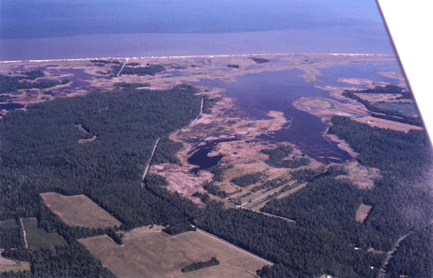
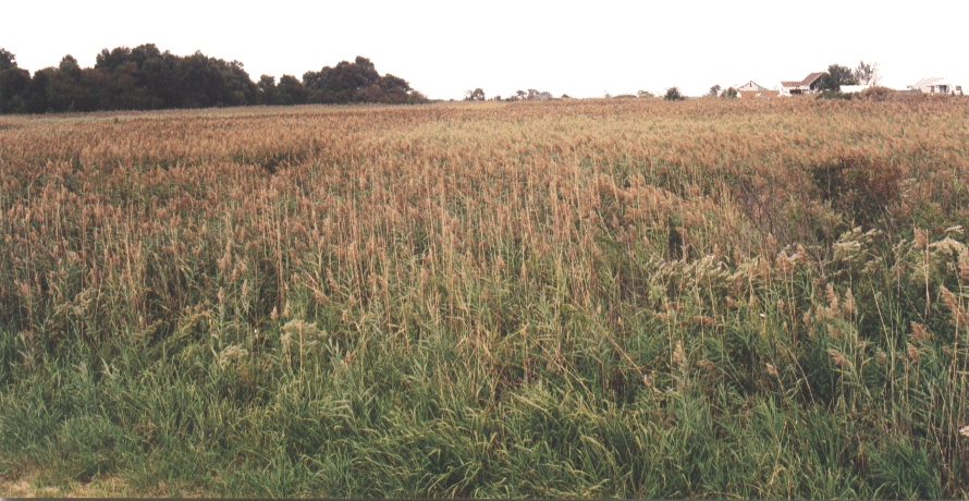
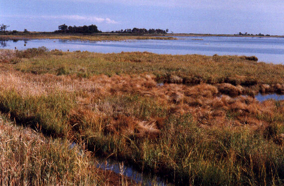
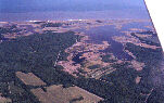
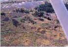
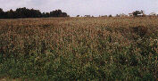
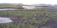
1. Air View of Lagoon portion of the Milford NeckWildlife Area looking southeast. Photo taken on 18 Sept, 1999; altitude about 3000 ft (900 m). Note forest, agricultural fields, tidal wetland vegetation.
|
|
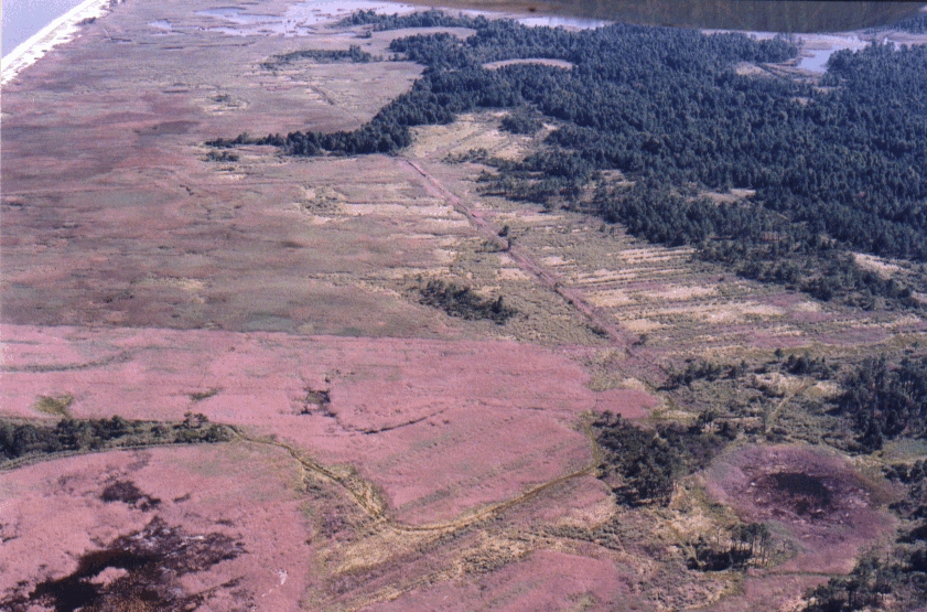
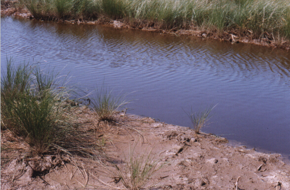
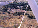
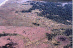
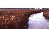
2. Air View of Milford Neck Wildlife Area looking north along Crooked Gut from the Mispillioin River. Note the visible signs of human manipulation of the tide marsh surface for mosquito control in the grid ditching cut in the 1930s and the recent sinuous Open Marsh Water Management (OMWM) cuts. Most of the visible vegetation is Spartina alterniflora. Light patches along the northern bank of the Mispillion River are salt hay (Spartina patens and/or Distichlis spicata). The areas of shallow standing water are features of the last 15 years. Photo taken on 18September, 1999 from 3000 ft.
|
|
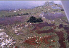
3. Air View of Greco’s Canal and inlet to the lagoon 18 September, 1999 from 1500 ft looking west. In the foreground is the poorly drained area east of the canal. In this scene the dominant vegetation is S. alterniflora with Phragmites occupying higher ground such as the spoil ridges and clumps along the ditches. [Phragmites canes remain standing in areas sprayed with herbicide in previous years.]
|
|
4. Air View of poorly drained area west of the canal 18 Sept 1999 from 1500 ft looking west. Vegetation among the grid ditching here is dominantly Phragmites both living and dead. Dead canes remain from herbicidal spraying in 1998. Areas of bright vegetation are apparently freshwater species such as Syperus sp. (umbrella sedge) and Hibiscus moscheutos (rose mallow) which are are observed on the ground to be replacing the dead Phragmites. Green streaks of live Phragmites can be seen. Little new growth occurrs in the purple colored areas which are still dominated by the dead Phragmites canes.
|
|
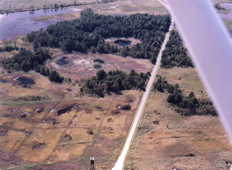
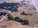
5. Air View of vicinity of Big Stone Beach Road 18 Sept 1999 from 1500 ft looking west. Vegetation south of the road is primarily dead Phragmites, but unsprayed live Phragmites dominates on the north side of the road.
|
|
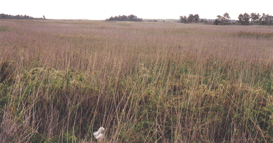
5a . Ground View of dead Phragmites on south side of Big Stone Beach Road. Photo on 18 Sept 1999 from road looking south on 10 ft ladder. Note Scirpus sp. growing among the canes in foreground.
|
|
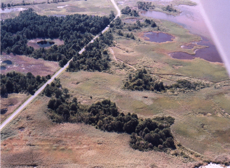
6. Air View of live Phragmites on the north side of Big Stone Beach Road. The Phragmites nearest to the viewer is tasseled and has begun to become senescent while the Phragmites farther to the west remains green and less mature. Photo taken on 18 Sept 1999 from 1500 ft looking west.
|
|
6a. Ground view of live Phragmites on north side of Big Stone Beach Road. Photo taken on 16 Sept 1999 from a 10 ft ladder on Big Stone Beach Road looking north.
|
|
7. Air View on 18 Sept 1999 from 1500 ft. of Phragmites canes in foreground and live Phragmites beyond. Note light colored patches of salt hay and lines of high tide bush along the ditches.
|
|
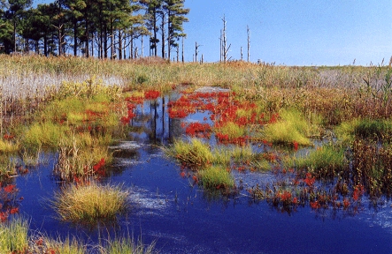
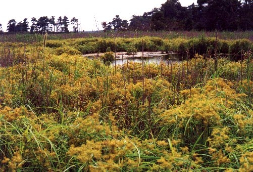
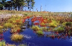
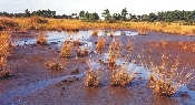
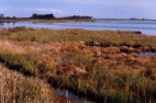
8. Flaming red senescent Salicornia europaea and clumps of salt hay are disbursed in standing water. Behind can be seen dead Phragmites canes remaining from herbicidal spraying in previous years and regrowing Phragmites beyond. The dead pine trees, common along the wetland margin of the pine forest of Milford Neck, attest to the rising average water level in this area. The water level at this time is unusually high. Photo at taken 28 Sept, 2000 at Point 405 b looking southeast. Salicornia is partrticularly tolerant of the high salinity often associated with salt pan areas.
|
|
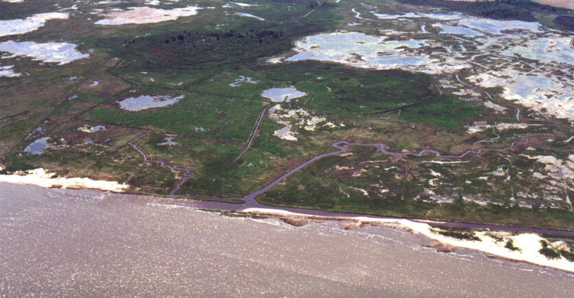
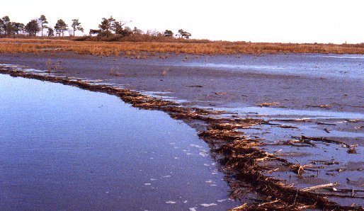
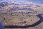
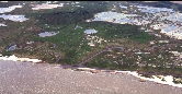
9. Aerial view of the breach in Greco’s Canal shows the shoal which constricts the tidal flushing of the lagoon area. The gut we named South Creek, seen entering Delaware Bay at the breach in the canal, meanders to the west where it connects with Crooked Gut in the area of shallow water/tidal flats. Photo taken 28 May, 2000.
|
|
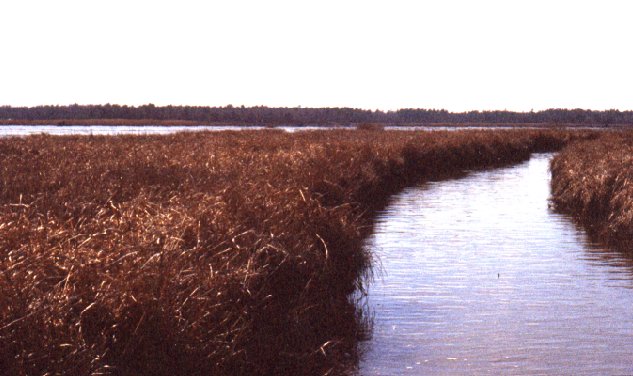
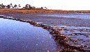
10. Looking north along Crooked Gut. This marsh area of open water, mud flats and sparse canopy of S. alterniflora is classified as shallow water/tidal flats. Photo taken 17 June 2000.
|
|
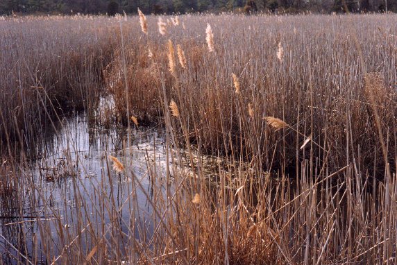
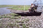
11. Photo showing the air boat transport which is required for accessing this portion of the Wildlife area. Location is Crooked Gut near photo 10. Photo taken 17 June 2000.
|
|
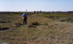
12. View, looking south east, of un-vegetated tidal flat at near low tide. The diurnal tide range here is about 10 cm. Usually at high tide the flat is submerged under only three to five cm of water.
|
|
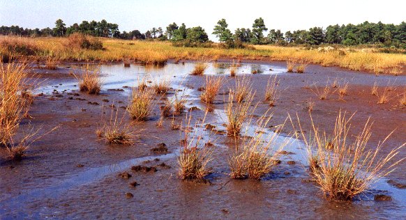
13. View, looking north east, of sparsely vegetated tidal flat created by the increasing duration of flooded conditions. The clumps of S. alterniflora vegetation are remnant of the full canopy which previously occupied this area. Photo taken on 11 Oct 2000.
|
|
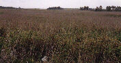
14. View, looking west, of a thick canopy of S. alterniflora.. Canopy height is 60-80 cm. The color reveals winter time senescence. Canopy of this density develops on the somewhat higher low-marsh surfaces on the levees adjacent to tidal channels. In 1973 the vegetation here was salt hay. Photo taken on 17 Feb 2000.
|
|
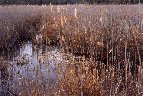
15. View looking west of Phragmites canes. The standing water here shows little evidence of regular tidal fluctuation and is usually fresh, except after occasional major storm or persistent high tide events. Herbicide has been used here to control Phragmites expansion. Visible are canes with inflorescence remaining after the just completed growing season as well as canes (without inflorescence) remaining from herbicidal treatment in 1998. Photo taken on 17 Feb 2000.
|
|
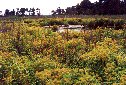
16. View looking south west of clumps of S. patens (salt hay) surrounded by S. alterniflora. and stunted high tide bush. These clumps of salt hay and high tide bush are remnants of high marsh vegetation surviving on slightly elevated mounts of organic matter. The increasing flooding frequency associated with the rising water level favors the expansion of S. alterniflora. Photo taken 17 Feb 2000.
|
|
17. View, looking south, of a typical high marsh salt hay patch. After mid growing season the canopy of S. patens characteristically becomes lodged ( licked in local parlance), producing a bright reflectance spectrum facilitating its remote identification. Beyond are stands of Phragmites and high tide bush. Note penetration of S. alterniflora into this high marsh area.
|
|
17a. View looking west of typical low marsh S. alterniflora canopy.
|
|
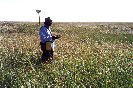
18. View looking south of fresh water area previously infested by Phragmites vegetation after herbicidal treatment in 1998. Umbrella sedge, Cyperus strigosus, is flourishing among what appear to be canes of herbicide treated Phragmites. [Canes of something else are also visible]. A number of freshwater species can be found in this area apparently taking the place of the eradicated Phragmites including Rose mallow, Hibiscus moscheutos, several asters such as Pluchea odorata, and Joe-Pye-weed Eupatorium maculatum.
|
|
19. OMWM ditch shortly after construction. Recently excavated dried mud renders the surrounding marsh surface uncharacteristically bright. This has no effect on the water reflectance observed on the ground but increases the apparent reflectance of the water as recorded by the airborne spectrometer.
|